If you are new to Jefferson County or St. Lawrence county, and you like to fish, you will find out how to fish the Oswegatchie River, as well as the West Branch Oswegatchie, in this post.
There are dozens of rivers, creeks, brooks and streams in Jefferson and St. Lawrence counties. Of these, the Oswegatchie is one of the longest and most interesting because it goes through so many different types of landscapes.

Our family only recently moved to North Country, but I remember my dad telling me about a trip he took with his parents to canoe the Oswegatchie River when he was a kid. Over the course of the past few months, we have really gotten into fishing, and so naturally we had to visit the river that my dad remembered so fondly.
Since we’ve been spending so much time driving around looking for the best places to fish in Jefferson County and St. Lawrence County, I decided I would write up some articles with what I discovered.
My criteria for a “good fishing spot” is a place where it isn’t too overgrown, since who wants to spend the evening picking ticks off the kids, and it can’t have too many weeds and debris on the river bottom or shore to get stuck on. Plus, it has to be a place where we’ve actually caught fish!
Even though we fish from the shore, as an added bonus, I have only selected places where you could get a small boat or canoe into the water. If you have a larger boat, there is one improved boat launch mentioned below.
I have included photos of the fishing access sites, whenever possible. Personally, I love to see photos of places that I go beforehand to help with planning.
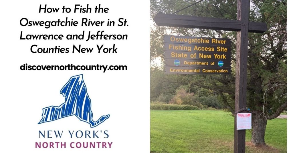
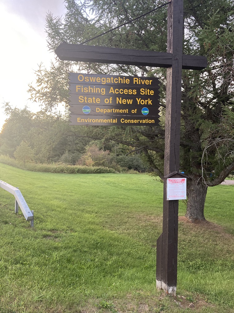
Oswegatchie River Public Fishing Access in Oxbow, NY
You can fish the Oswegatchie River in Oxbow, New York by accessing the public fishing access site located on County Road 25 just east of the Village of Oxbow. The short road to the access spot is located across the street from the Oxbow New Cemetery.
Directions to the Oxbow/Antwerp fishing access on the Oswegatchie: Click to open directly in Google Maps
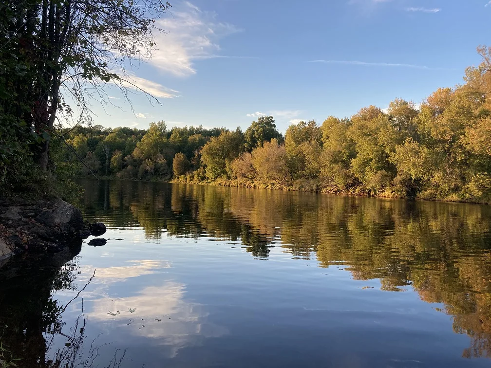
This fishing access spot on the Oswegatchie, which might technically be in Antwerp, was the first place that we visited, primarily because it is the closest fishing access on the river to where we live. Coincidentally, this is also the closest direct access point to the Oswegatchie river if you are coming from Watertown or Fort Drum, NY.
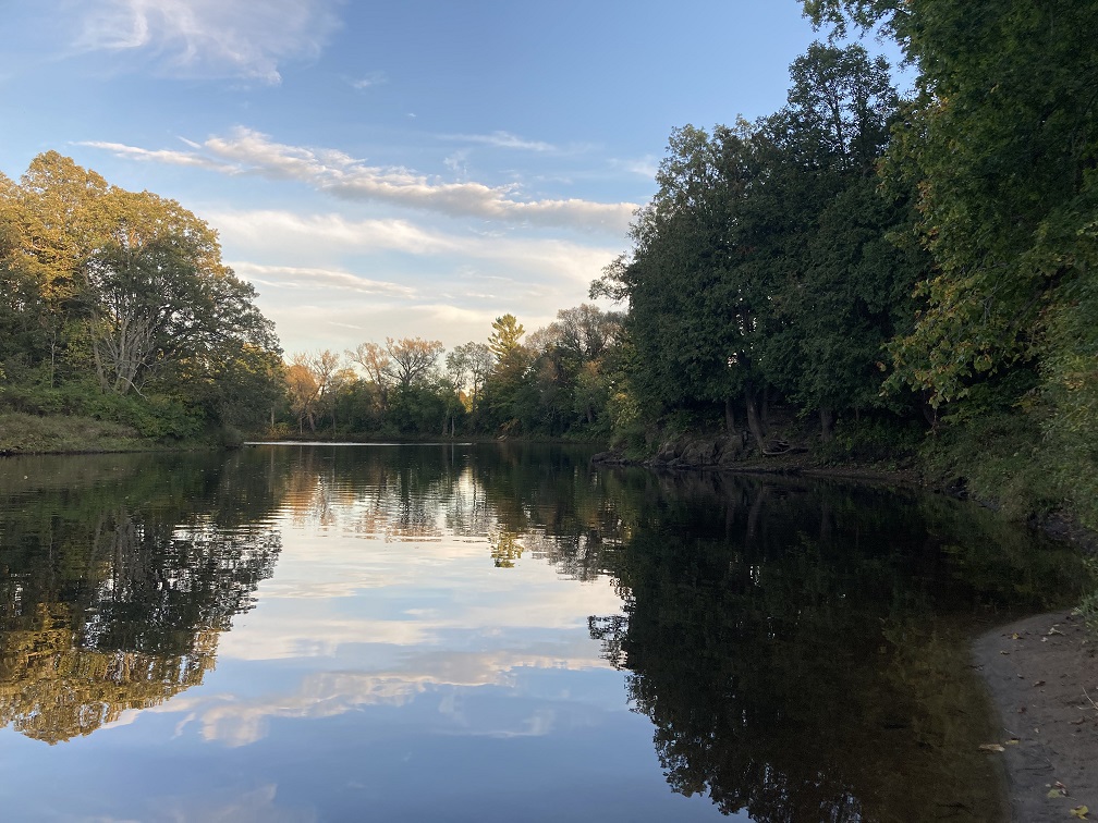
No matter what time of the year we go, it is always beautiful.
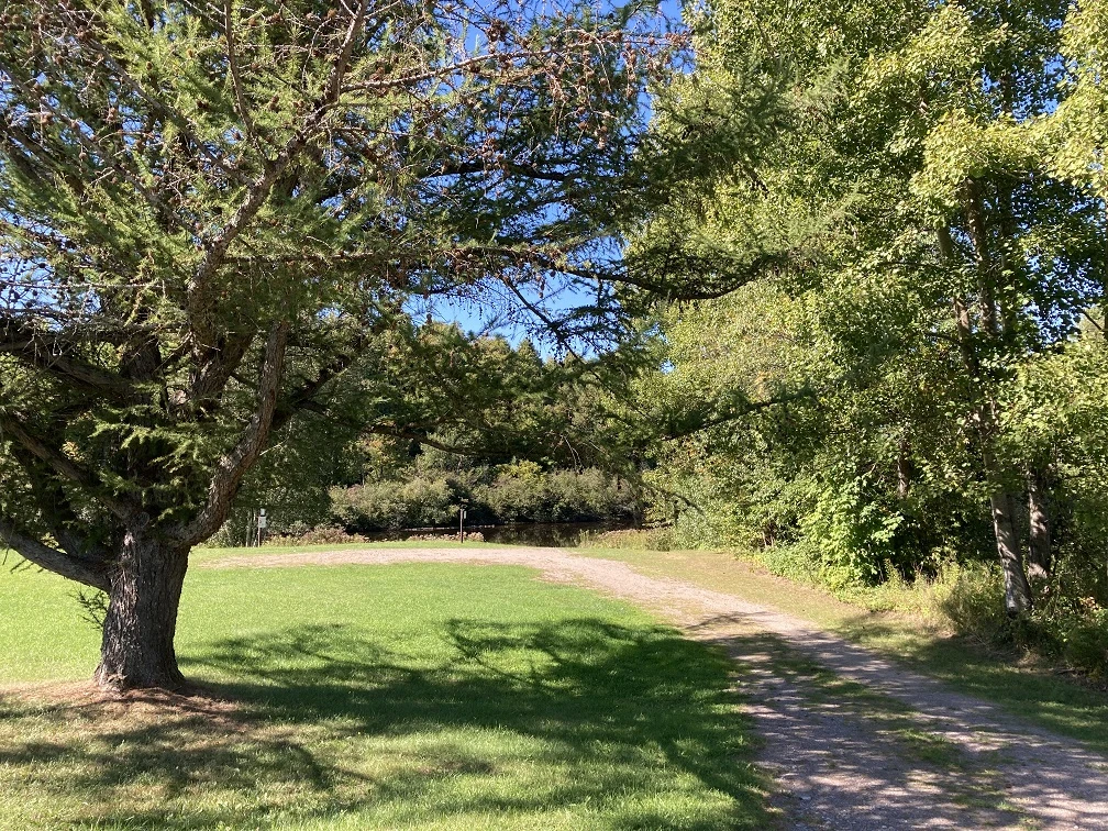
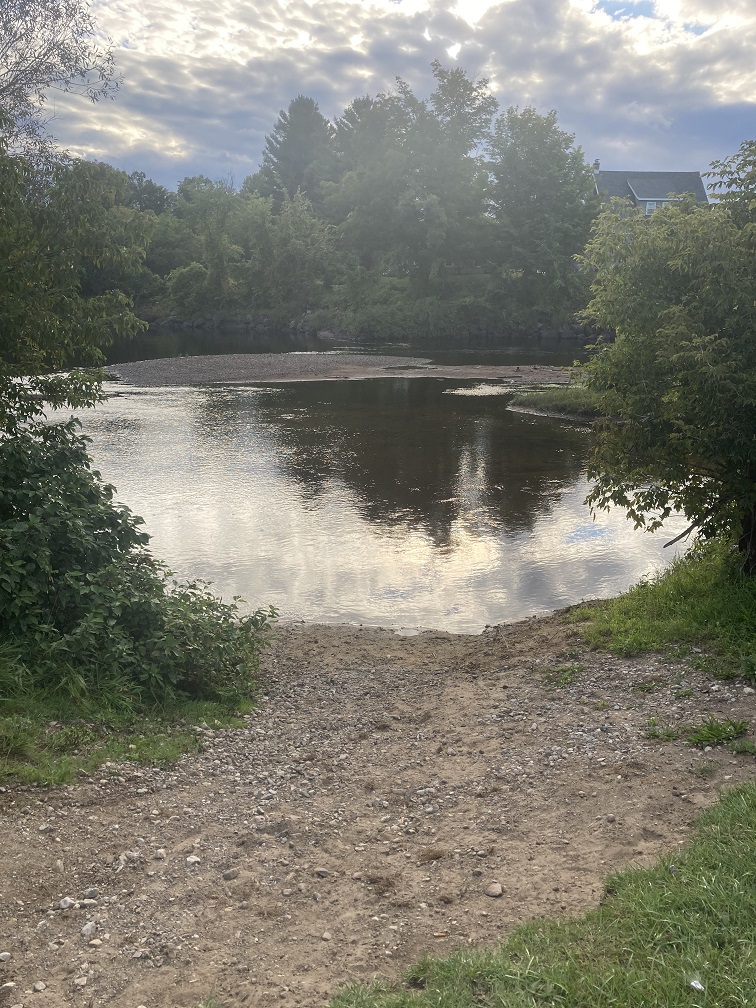
Below is a photograph of the actual fishing access site at Oxbow. As you can see, there is only a small gravel/mud spot where you could put in a small canoe, or fish from the shore.
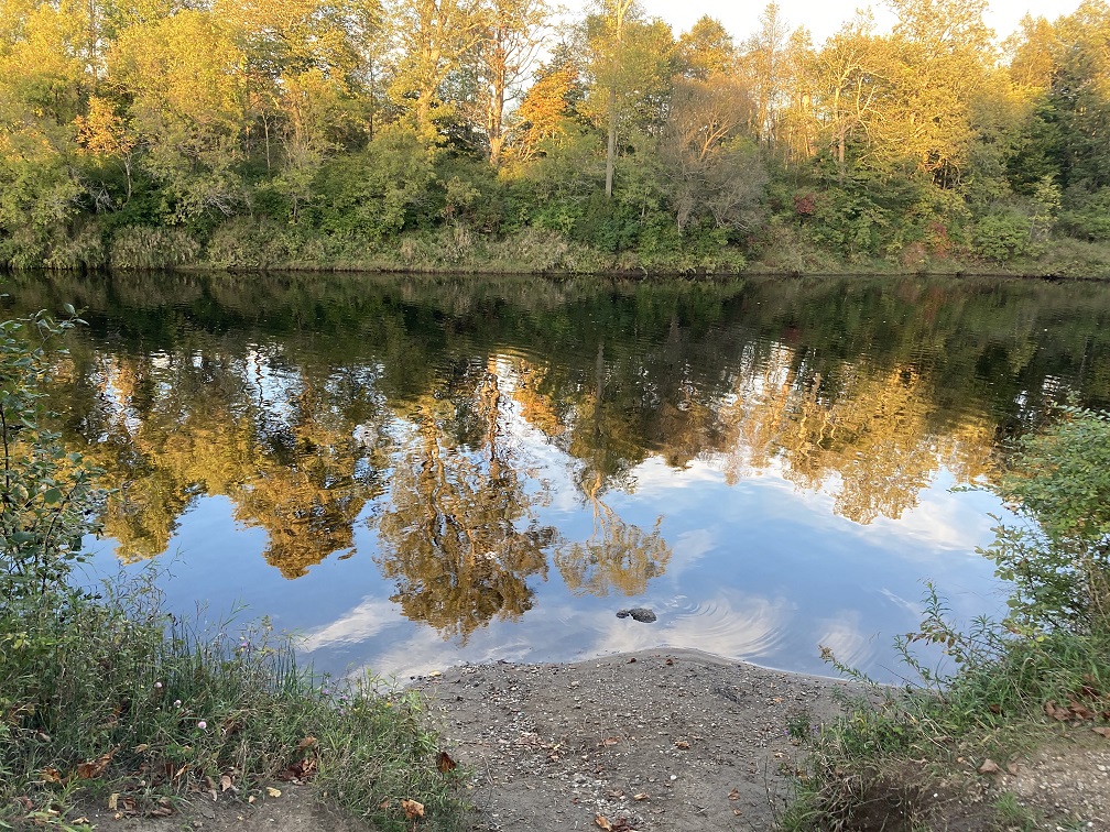
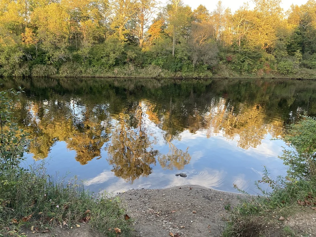
This is a particularly pretty and serene part of the river. It was hard to choose a “most beautiful” spot on the Oswegatchie, but this is definitely one of the best ones.


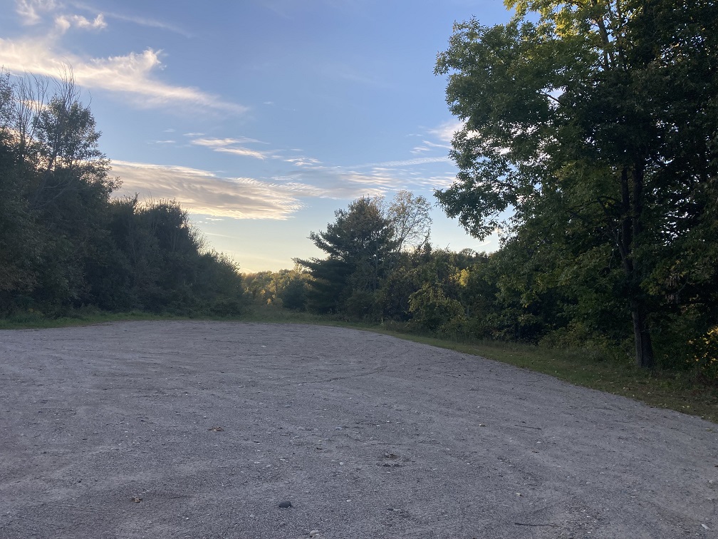
There is a large gravel/dirt parking lot available at Oxbow at the NYS DEC fishing access site. I have never seen more than 1-2 cars there at a time, however.

There are no bathrooms available at this fishing access site. In addition, it is important to know that the closest store is the Oxbow Country Store, which is located less than a mile away from the Oxbow fishing access site.
The Oxbow Country Store sells groceries (like snacks!) and gas and is usually open between 7 am – 6 pm. You can visit their Facebook page for updates if you will be in the area and might need to visit their store.
Flat Rock Picnic Area on NY-3 in Oswegatchie
An interesting place to fish the Oswegatchie River in St. Lawrence County is near the dam at Flat Rock Picnic Area off of NY-3, a site maintained by Brookfield Power New York. There is an improved boat launch, as well as a well-maintained picnic area, as well as ample parking.
This picnic, fishing, and boat launch area is technically located in the Adirondack Park region of New York, which is an extra bonus. It is a very beautiful section of St. Lawrence County, and the drive there is enjoyable.
Below is a photograph of the picnic area taken in early September. It was still technically summer, but you can see how the leaves were already starting to fall.

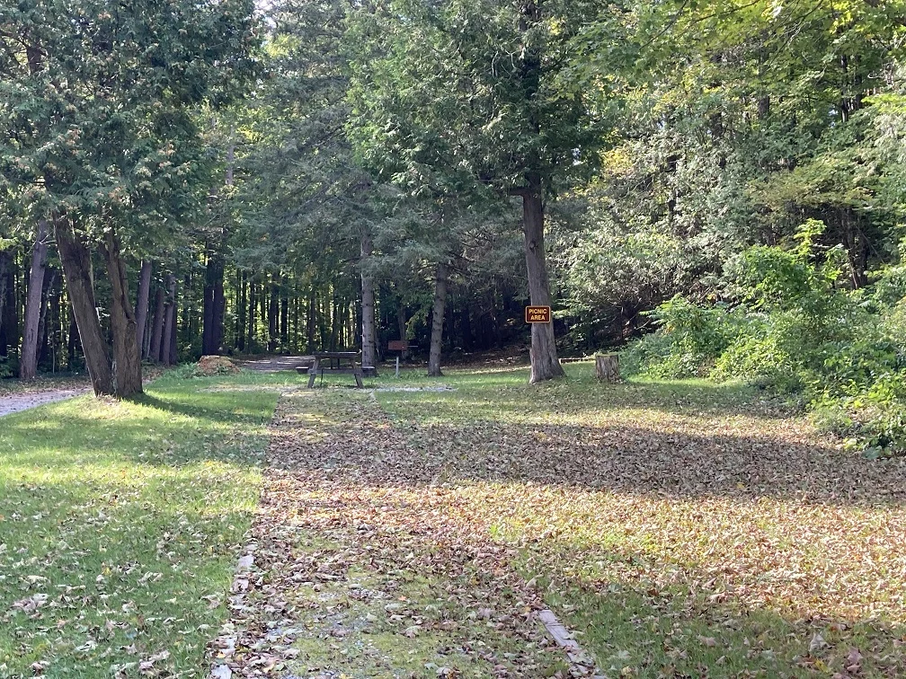
There are no hiking trails at the picnic area, but there is a short path leading from the parking area up to a flat area near the top of the dam. You can get a nice view of the river before the dam.


I didn’t get a photograph of the actual fishing area and boat launch, since I received an urgent phone call from a relative exactly at the moment that I was going to snap the photo. Sorry! If I head over to the area again in the near future, I will be sure to grab a photograph to add to this post.
The Flat Rock Picnic Area is located at 3147 NY-3, Oswegatchie, NY 13670. Alternatively, you can click to automatically open the coordinates to the site using Google Maps.
There is no bathroom at the Flat Rock Picnic Area. The closest restaurant is the Hillside Diner (about 1 mile south going towards Star Lake) which is located at 3386-3290, NY-3, Oswegatchie, NY 13670.
The closest gas station to the Flat Rock Picnic Area is the Circle K gas station in Star Lake, NY, which is about 6 miles on Route 3 in Star Lake.
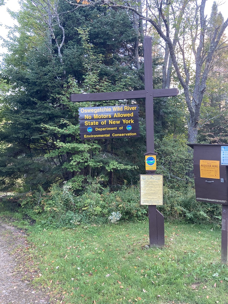
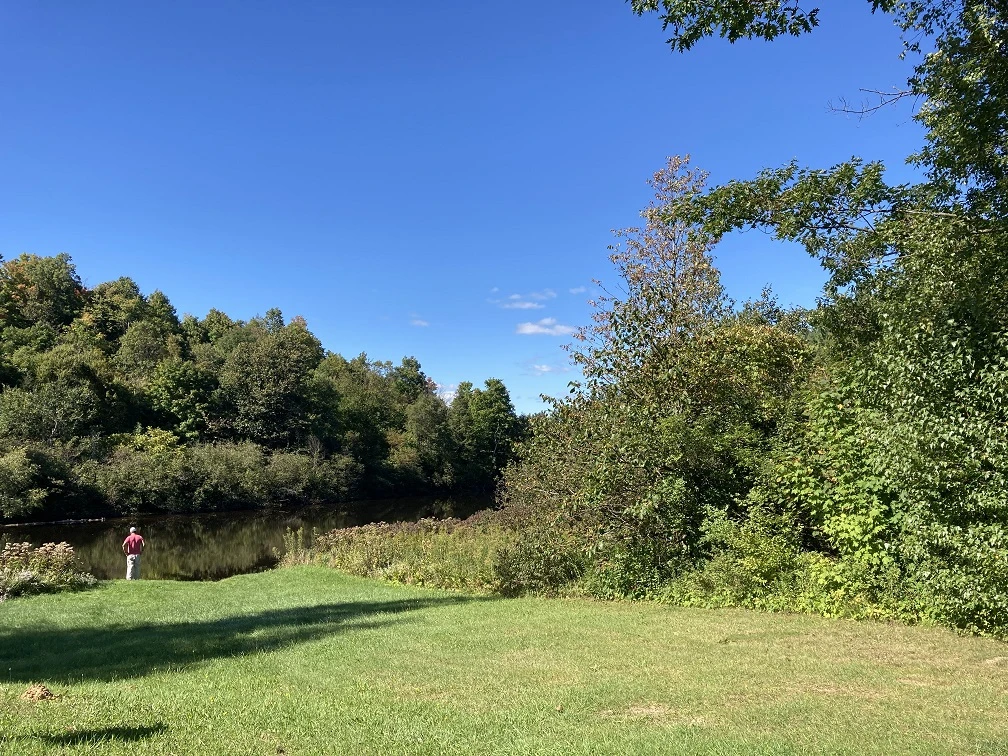
Oswegatchie River Inlet Hand Launch in Wanakena, NY
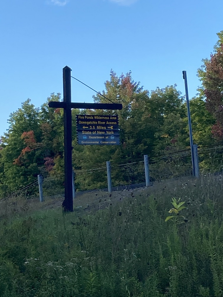
The Oswegatchie River Inlet Hand Launch and fishing access spot is located on Inlet Road, a small gravel road that takes you south from NY-3 through a beautiful forest to the hand launch, which is at the edge of the Five Ponds Wilderness Area.
When you first turn off of NY-3, be careful to turn left immediately to be on Adirondack Park Road, which leads you to Inlet Road. Inlet Road is a gravel road, but it is well-maintained.
For directions to this fishing access site at Oswegatchie Wild River Access and hand launch: Click to open coordinates in Google Maps
The hand launch is about 3.5 miles off NY-3, but it seems like it takes about 15 minutes to get there. Travel on the gravel road is slow, but worth it – and the forest is just beautiful.

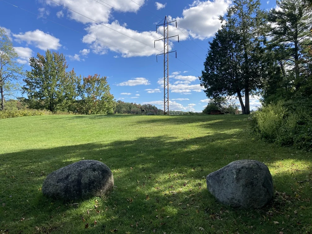
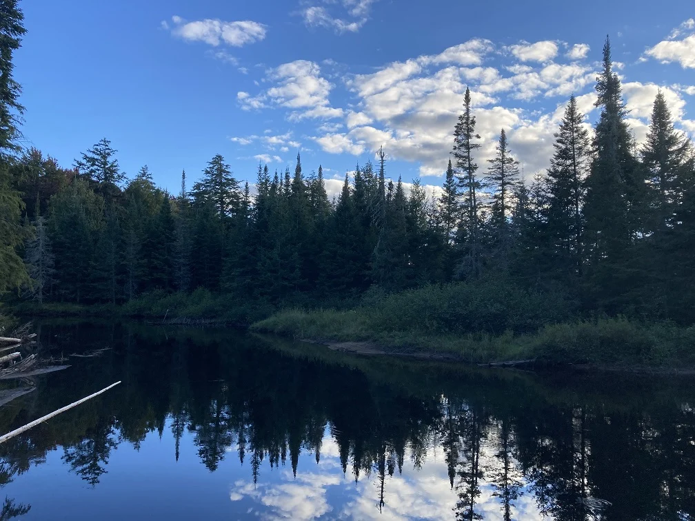
I’m so excited to write this part of the post because this is my absolute favorite access point to the Oswegatchie River. It’s beautiful, pure wilderness and it looks like a fairy tale forest.
If you canoe or kayak, I bet this it is even more beautiful. We have met quite a few people coming back from kayaking here, and everyone seems to love it, as long as you can navigate around the multiple beaver dams that are upstream.
Below is just one scenic view from the shore at the hand launch. There is plenty of space to fish from shore, including a grassy (mowed) spot that is to the left of the launch, and a sandy place at the launch.

If you pull up to this spot and the parking lot is full, don’t despair. Even though on the days that we have visited, there have been 8-10 cars in the parking lot, everyone else seems to either hike or kayak up the river, leaving plenty of space to enjoy fishing from the shore or hiking into other parts of the wilderness area.
There is a small, very basic outdoor bathroom at this fishing access site. It is labeled “privy”, and you can see the sign pointing towards the tiny restroom, which is essentially a latrine, if you stand at the side of the parking lot opposite the picnic table.
West Branch Oswegatchie River Fishing Access for the Public in Fowler, NY
The West Branch Oswegatchie River flows from Hog Pond near Webb, NY in Herkimer County. The West Branch Oswegatchie River flows north into the main Oswegatchie River just south of Wolf Lake State Forest, only a few miles away.
There is public access to West Branch Oswegatchie for fishing, as well as putting a small boat into the river, in Fowler, New York. You can find this fishing spot on NY Route 58 in St. Lawrence County (click here for coordinates in Google Maps for directions).
Below is what the sign looks like, which is on the right side of the road if you are heading west:
We have fished this spot a few times and caught some fish, primarily small-mouth bass. The river isn’t very wide at this point, so you can easily cast to the middle or clear to the other side
Even though there were a few weedy areas near the shore, even the kids didn’t get their lines or hooks stuck. All in all, it was a decent place to go fishing.
Below you will find a photograph of the gravel, yet large, parking area, and the grassy area by the shore. The fishing spot by the shore is grassy, but the state does mow it regularly.


If you are looking for a quiet place to fish where you aren’t likely to encounter crowds, this is the place for you. We only saw a few cars drive by the entire time that we were there, and no one else stopped to fish or put their boat in the water.
This fishing area is located in a residential-type area, so there are private homes adjacent to the public access area. Just something to keep in mind as you plan your activities there.
There are no bathrooms available at this fishing access site. The closest amenities will be available at places like Bob’s Groceries in Fowler, NY, which you will find just a few miles west on NY Route 58.
Gouverneur is also fairly close to this fishing access site, and you will find a wider variety of gas stations and restaurants to choose from there.
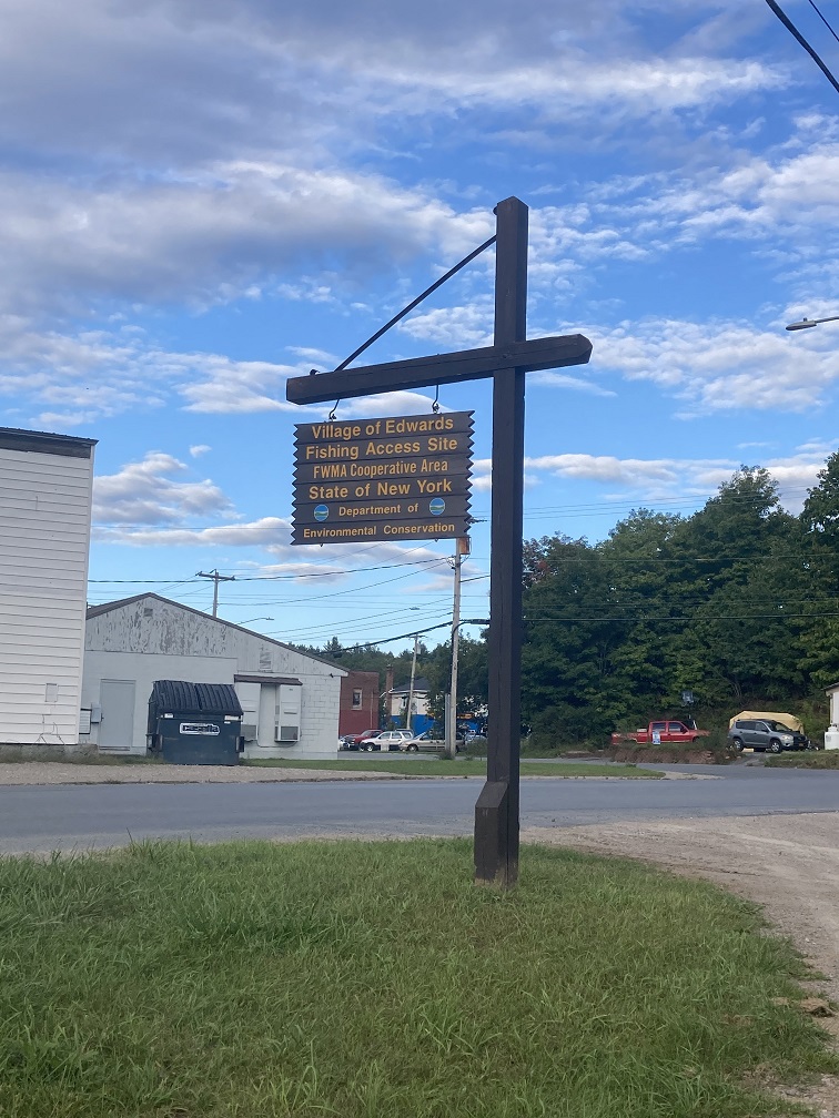
Village of Edwards Fishing Access Site for the Oswegatchie River
Another great place to access the Oswegatchie River is at the Village of Edwards, New York, which is located a few miles east of Wolf Lake State Forest. You can easily access this fishing spot by taking Highway 11 to Gouverneur and heading east on New York State Route 58, which crosses through Edwards.
For directions to this fishing spot in Edwards NY on the Oswegatchie: Click to open coordinates in Google Maps
Below is a photograph of what the river looks like at the shore of the river. The bridge over the Oswegatchie River (NY-58) here is to the right of what you see in the image below.
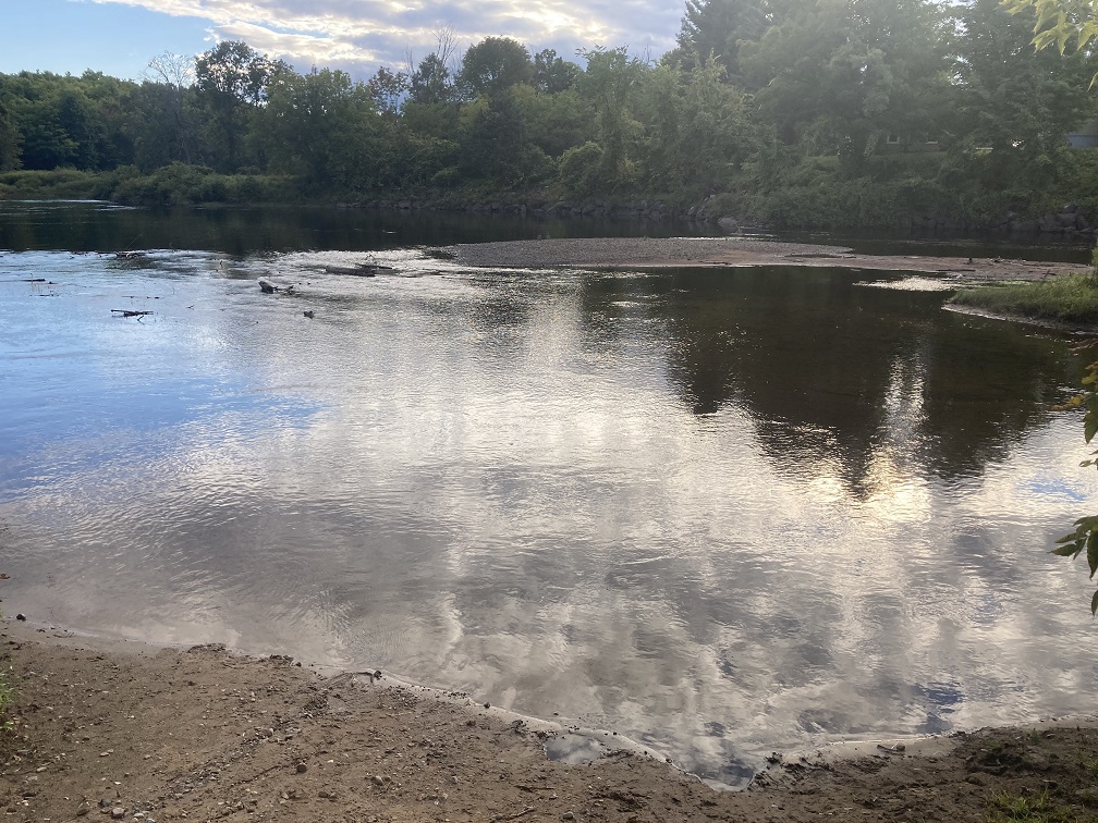
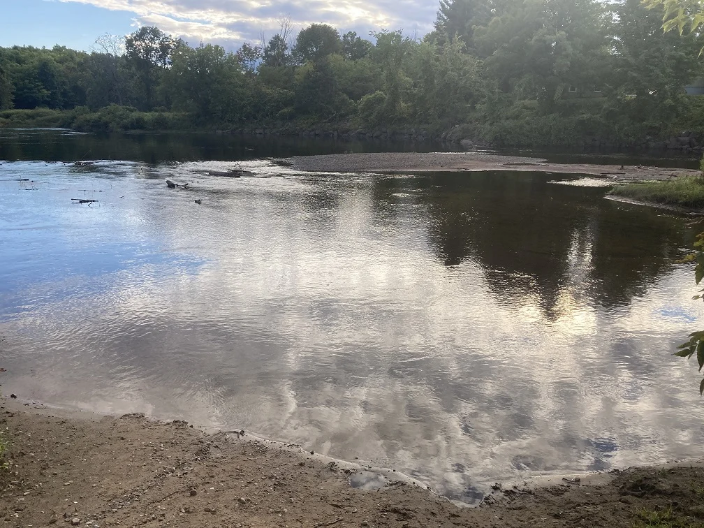
The river is very shallow right at the shore, but there is deeper water on the other side of the sand banks. I am not sure how easy it would be to get a canoe into the water at this location, since it really is quite shallow right at the shore.


There is lots of great fishing to be had at the Oswegatchie, and this location at Edwards NY is a convenient spot. As an added bonus, Edwards is a town with at least one gas station and convenience store, and is not too far away from Gouverneur where you can find all sorts of amenities, even fast food.
As you might already know, one of the advantages of exploring nature in St. Lawrence and Jefferson Counties is the rural and sometimes isolated nature of the available activities. This location at Edwards is one of the least isolated fishing spots on the Oswegatchie, other than the next spot on the list which is in Gouverneur.
Mills Park in Gouverneur off Johnstown Street
If you find yourself near Watertown and you need a hard ramp boat launch to fish the river, then you should take a trip up to Gouverneur. It’s only about 45 minutes from Watertown and 30 minutes from Fort Drum or Evans Mills.
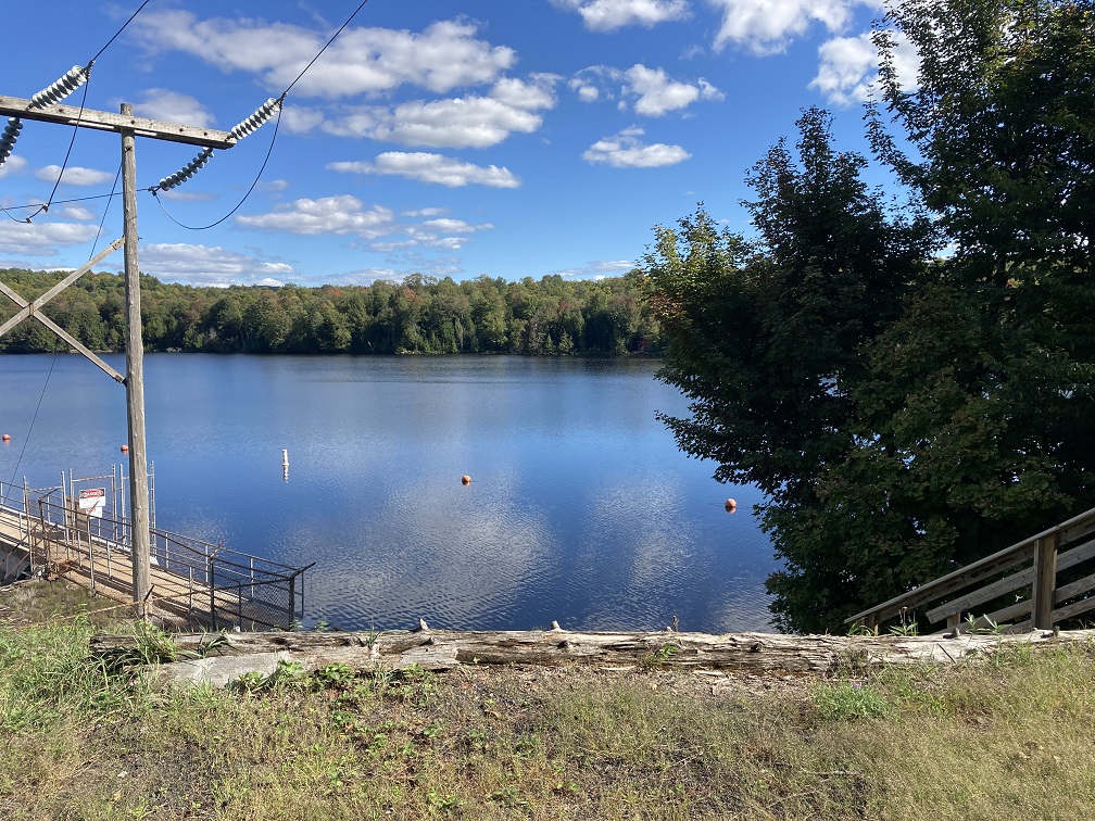
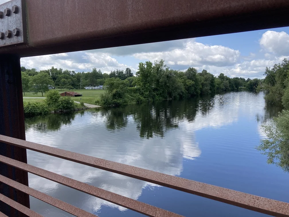
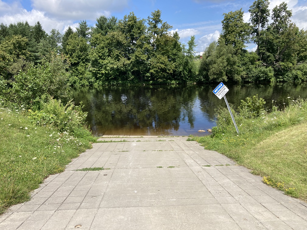
The boat launch is located at Harry J. Mills Park in Gouverneur, also known as simply “Mills Park”. You can get to this park directly from Route 11 by turning onto Johnstown St. You can also access the park by foot via the Gouverneur Riverview Park, but it is important to know that you can’t drive your car over the bridge.
The river is pretty wide at this spot and looks beautiful from the nice foot bridge over the river between the two parks. This is not a great place for fishing from the shore, admittedly, because the boat launch area is small and the river is shallow by the launch.
However, if you have a boat, you will not be limited by the shore fishing here.

So, if you have a boat you need to put into the water, your best bet is going directly to Mills Park. The sign needs some maintenance, but there are some ball fields and it is clearly marked as a park, as you can see below.

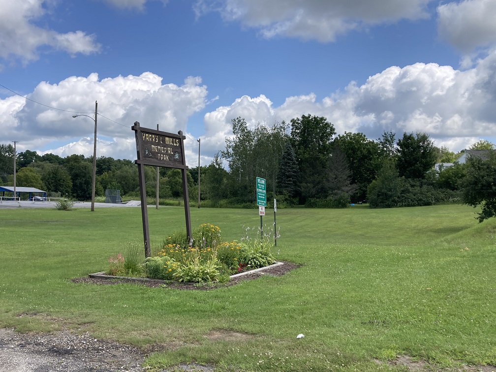

If you want to fish from the bridge, or do a little canoeing or kayacking, this is a fun place to visit with family because there are picnic tables on the Gouverneur Riverview Park side of the walking bridge. It could be a place to make a day out of time at the Oswegatchie River.
Another great reason to choose this spot to fish the river is because Gouverneur is one of the bigger towns in the region, you will find everything that you need as far as amenities go in this location. There are fast food restaurants, coffee shops, pharmacies, and even an Aubuchon Hardware (on Clinton St. in Gouverneur) to buy basic tackle, boating, or camping gear that you may have forgotten.
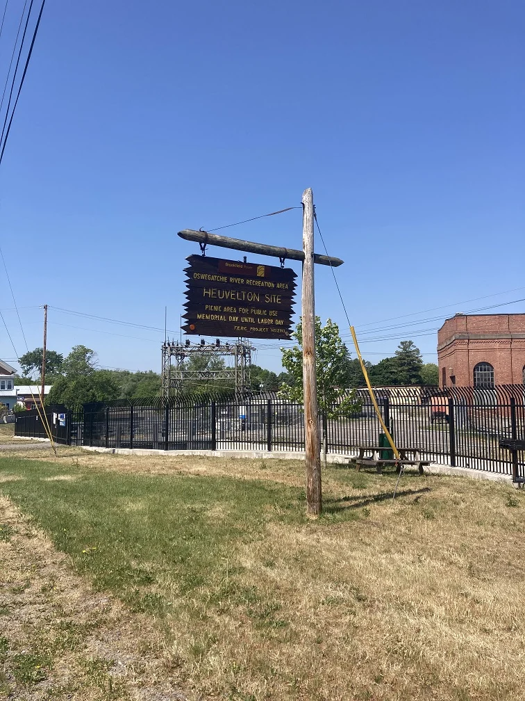
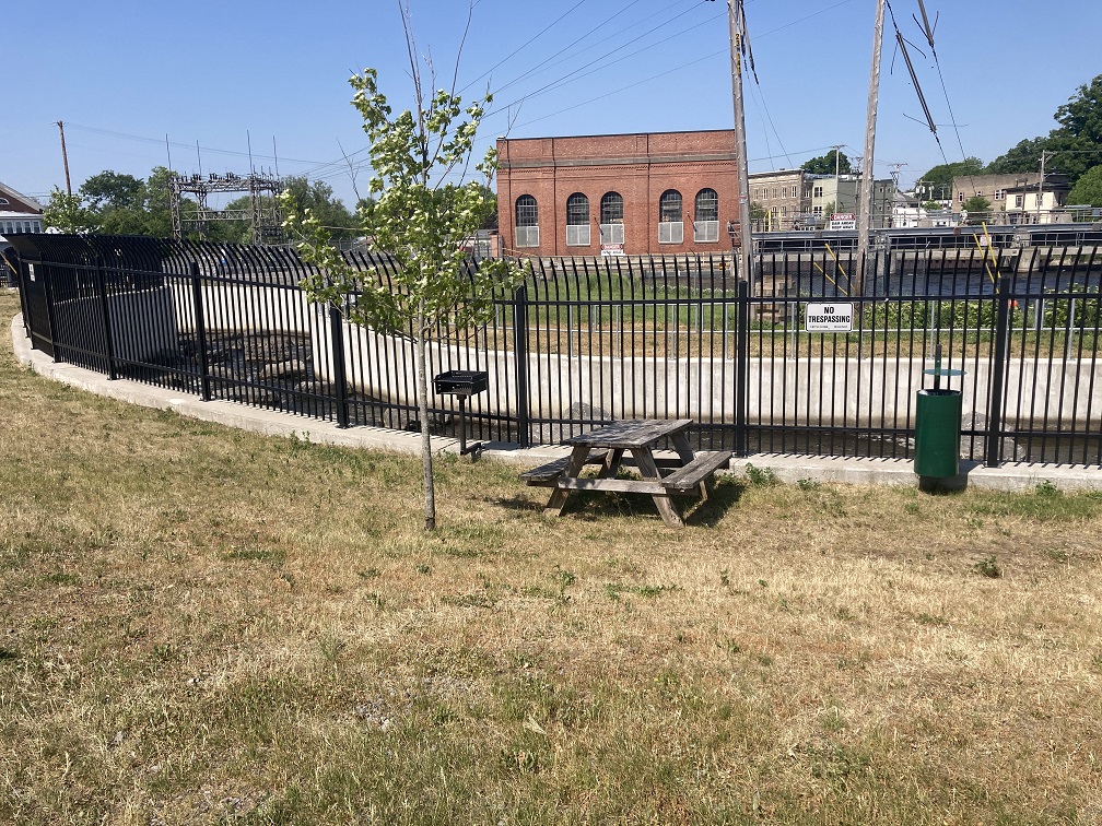
Day Use Picnic Area at Oswegatchie in Huevelton
This is a beautiful little spot on the Oswegatchie in Huevelton, but it is only good for putting in a small kayak or canoe. You won’t find it on the map, but you can get Google Maps coordinates by clicking here.
By the way, it’s “Hue-vull-ton”, for those who are wondering.
This is a picnic area that is in a residential neighborhood, but it’s a nice place to spend a quiet moment for a picnic before setting in on a fishing journey via canoe.
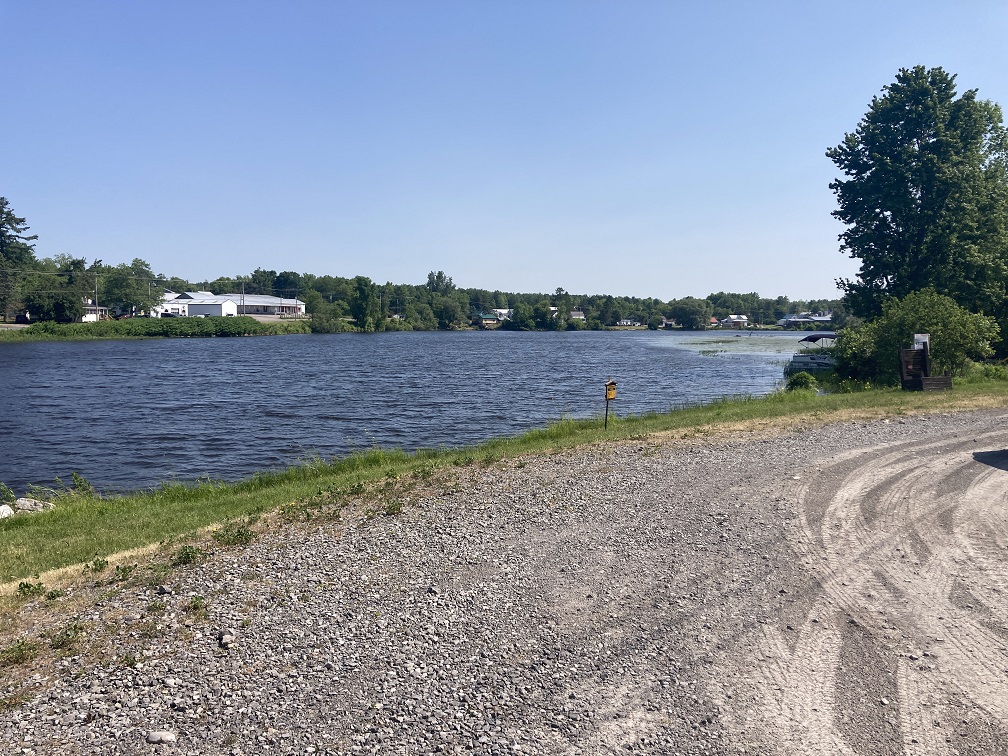

This is not a good place for fishing from shore because it is unclear if it is permitted, and it’s also probably not a great place to fish from the bank because it is very, very grassy.


Conclusion
That’s all! If I missed your favorite spot for fishing the Oswegatchie, please let me know in the comments below.
I hope that you found this list of ways to fish the Oswegatchie River in Jefferson and St. Lawrence counties helpful. It is such a beautiful place to explore, and I really do hope you get a chance to visit one of these places.
Thanks for reading today!